 Sodara Labs
LADStrademarkLow altitude drone sequencing
Overview
Identify every drone over your event, on one live map.
LADS™ by Sodara Labs coordinates and sequences drone flight paths and manages low-altitude drone operations for multi-drone deployments where multiple teams need situational awareness. Plan and deconflict every mission, detect every Remote ID broadcast, know which drones are authorized and which are not, and share one live picture.
- Air
- Ground
- 0
- Unknown
- 0
- Alert
Status
- Authorized
- Production or security drones, cleared
- Registered
- Known aircraft under review
- Unidentified
- Requires immediate investigation
- Unauthorized
- Flagged threat, act immediately
LADS HUB
Mission planning, live tracking, alerts and compliance records.
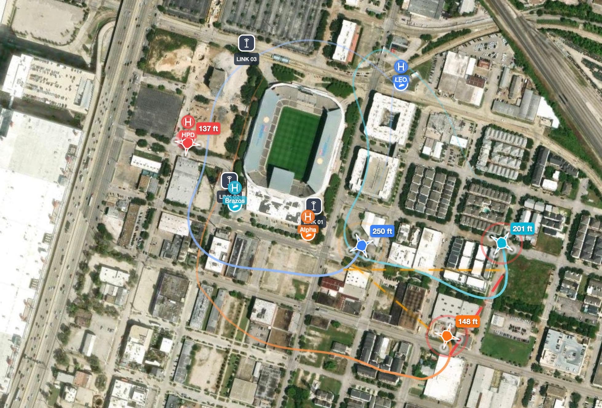
The LADS HUB is software for coordinating and sequencing drone flight paths and managing low-altitude drone operations. It is the web-based control center where everything comes together. Detections from every LINK at the venue flow into one live map that pilots, sequencers and event staff all work from. Missions are planned and sequenced before the event, every aircraft overhead is tracked live, and alerts fire when drones are in close proximity to each other. Every flight is recorded, so you can go back to any flight and review its data.
- Complete airspace awareness
- Every broadcasting drone and manned aircraft on a live map, classified by type and colour-coded by authorization. ADS-B transponder data included.
- Automatic ID and cataloguing
- Remote ID serial numbers resolve to manufacturer and model on first contact, building a persistent registry of every aircraft ever seen at your events.
- Mission planning and sequencing
- Waypoints, routes and area scans drawn on the map in the HUB, scheduled alongside the other flights at the event and shared with every pilot.
- 3D proximity and collision alerts
- The distance between every airborne pair is computed continuously. Cross a configurable threshold and the crew gets a visual and audio alert with a severity.
- Geofencing and FAA compliance
- Polygon fences with altitude floors and ceilings. Live TFRs, the LAANC grid and NOTAMs overlaid. Violations flagged instantly.
- Roles, accountability and reporting
- Owner, pilot and viewer roles per event. Every drone tied to a named operator. Searchable flight history and automated compliance reports.
- Deployment
- Browser-based. No app installs, no hardware beyond the detection units.
- Data sources
- FAA Remote ID, ADS-B and RF spectrum detection.
- Compliance
- FAA Remote ID rule (14 CFR Part 89), TFR, LAANC and NOTAM integration, exportable audit trail.
- Export
- CSV, KML, GPX.
LADS LINK
A portable receiver placed with each drone team
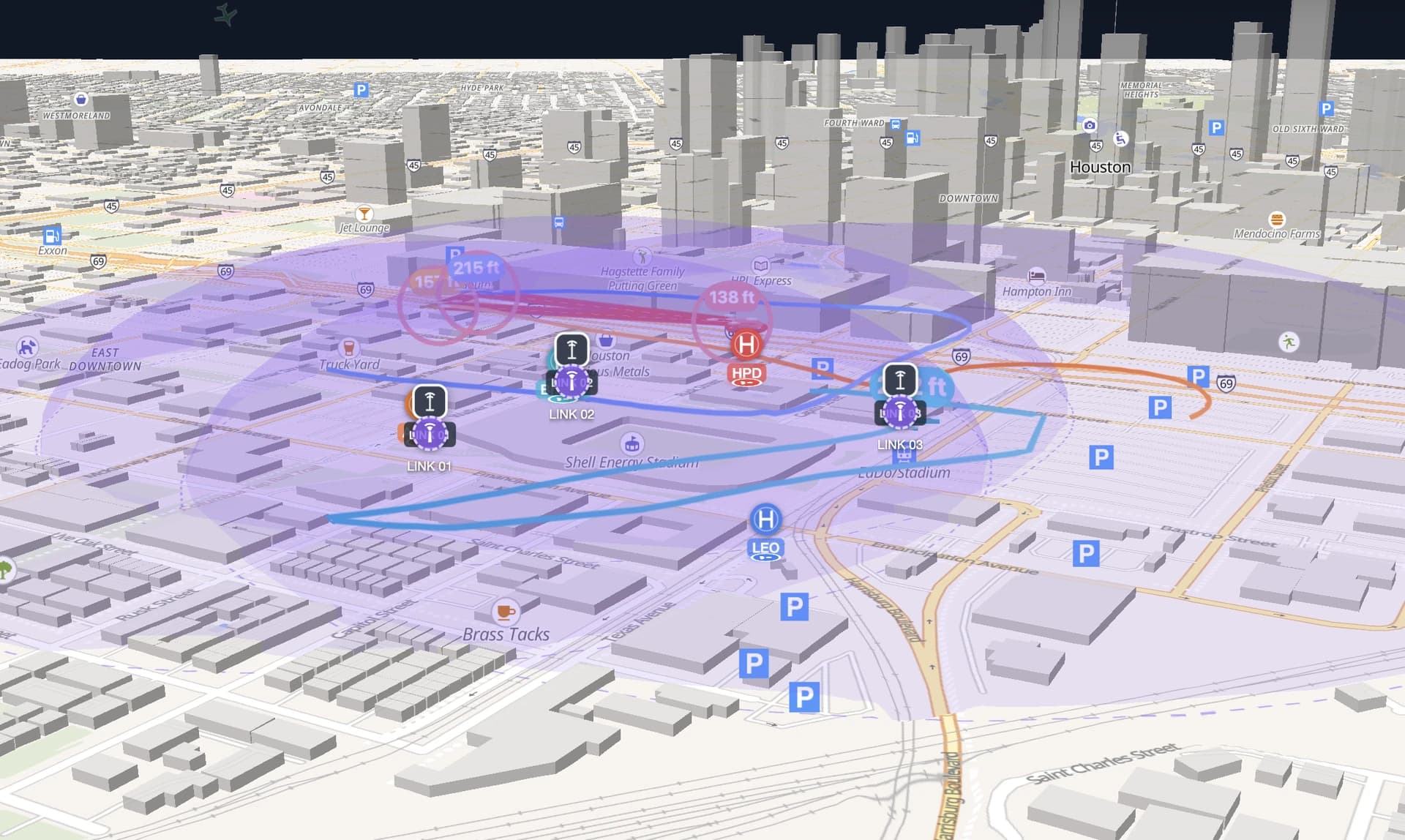
LADS LINK is a portable Remote ID receiver and drone detection unit, placed with each drone team. It listens for FAA Remote ID broadcasts, decodes them on the spot and streams every detection to the HUB. It is receive-only: it emits nothing and interferes with nothing. Place several LINKs around the venue and they mesh into one network: coverage grows to span the whole event and the units share one map.
How it works
Deploys in minutes.
Runs in your browser.
- 01
Pre-event setup
Days or weeks ahead: authorized drones registered and assigned to named operators, missions planned and sequenced, geofences drawn, FAA restrictions loaded.
- 02
Deploy
LINK units placed with each drone team on site and powered on. Coverage shows on the map within minutes, with any blind spots visible before the first flight.
- 03
Live operations
The map is live. Alerts fire on their own. Security, pilots and FAA observers each see the view their role allows.
- 04
Post-event
Compliance reports generated. Incident timelines reconstructed from the synchronized data of every detection unit.
Get a LINK
Rent LADS LINK units for your event.
LADS LINK units are rented by the day, with as many units as needed, through an Authorized Rental Partner. Tell us about your event, the venue and the dates, and we will put you in touch with our rental partner. The units arrive in the flight case with everything you need for that LINK, including one LINK and four batteries. Each LINK comes with HUB access included.
- Receive-only
- A LINK emits nothing and interferes with nothing.
- Ready in minutes
- Power it on and it reports to your HUB project.
- Meshes into one network
- Place several LINKs around the venue and they share one map. Coverage grows to span the whole event.
- Hub access included
- Up to 10 users per LINK for the event. Every additional LINK adds more.
Why LADS
Questions about LADS
How does sequencing work?
Missions are planned on the map in the browser as waypoint routes, area scans and drone pads, built on geofence and live TFR data, and worked from live by pilots and sequencers. Live proximity alerts keep the sequence honest once aircraft are in the air.
How many drones are in our airspace?
A live count of every drone and manned aircraft, classified and colour-coded.
Is that drone authorized?
Automatic identification, a persistent registry, and a four-level authorization status.
Who is flying each drone?
Every drone is tied to a named operator, and the operator’s broadcast position is shown on the map.
Are any drones too close to each other?
3D proximity detection between every airborne pair, with predictive alerts and audio warnings.
What does “passive detection” mean?
LADS listens for the Remote ID signals drones are required to broadcast. It emits nothing, jams nothing and never interferes with a flight. It is receive-only, like listening to a radio station.
What happens during an incident?
Timestamped flight paths, operator identity and geofence records, replayed minute by minute.
How many drones can the system track at once?
There is no cap. Every aircraft broadcasting Remote ID within range of your LINKs appears on the map. The practical limit is RF density at the site.
Contact
Get in touch.
Tell us about your next event, where you plan to fly and how many drones, and we will be in touch soon.